Wednesday, 31 January 2018

Long ride to Tapah-Chenderiang-Sahom

It's Wednesday, 31st January 2018, and we're embarking on a long ride on this last day of January.

Our aim was to cycle on a loop from Kampar through Air Kuning, Banir, Tapah, followed by two small hill climbs through Chenderiang, down to the foothills at Sahom and Sungei Siput South before proceeding northwards to Gopeng then southwards back to Kampar via Kopisan Lawan Kuda and Kota Bahru.

0704hr Ganesans house 4.12km
There were four of us in this ride: me, Ganesan the event host, Adrian Wong and Thaneswaran. We set off from Ganesan's house in Jalan Degong Kampar shortly after seven o'clock and headed west towards Mambang Diawan.

0708hr Leaving Ganesans house 02 4.12km

0726hr Towards Mambang Diawan

The ride to Mambang Diawan was easy and quiet with some swift but occasional traffic passing us along the way.

0727hr Towards Mambang Diawan 02

Just before Mambang Diawan village, I came across a Shell service station and decided to stop to inflate by bicycle tyres. I had been busy recently and didn't find time to bring the bicycle out to the petrol station in Kampar new town to pump it up to standard pressure of 50 psi.


0730hr Inflated tyres at Mambang Diawan Shell
We continued our journey, passed through the main road of Mambang Diawan, and by about a quarter to eight we were approaching Air Kuning town.

0742hr Towards Air Kuning

It was about eight o'clock when we arrived at our usual breakfast stop: a road-side shop in Air Kuning, where I had my second cup of black coffee and a small bean paste dumpling.

0809hr Breakfast at Air Kuning 02 15.83km

0813hr Breakfast in Air Kuning 15.83km


At 8:18 am, we resumed our ride towards Banir Village, on our way to Tapah. It was a straight and quiet road most of the way, with gentle gradients. The cool morning weather with cloudy skies made it a pleasant ride.

0823hr Road to Banir

0829hr Road to Banir 02


0851hr Banir almost there

Banir came and went with stopping at about nine o'clock. It was about 26km into our ride and we cruised onwards to Tapah.

0902hr Just passing Banir 26.01km


0904hr Junction Banir to Tapah After 26km


0910hr Reached Banir - Tapah junction 26.01km

There's a new park on the main approach to Tapah town that I haven't visited before. It's called Dataran Amanjaya Temoh, named after Temoh, a small town nearby. Adrian and I decided to detour into the park and look around. There were a few families and young people around, some walking, some jogging and some just sitting down looking at their children run around in the park.

0909hr Drop by Dataran Amanjaya Temoh

After exploring Dataran Amanjaya Temoh briefly, we resumed our journey southwards, arriving on the northern fringe of Tapah town at about 9:45 am. We have cycled a distance of 34.61km.

0934hr Road to Tapah 02

0945hr Reached Tapah 34.61km

It was Thaipusam day this 31st January, and the Hindu temple near the junction of the road leading uphill was crowded with people. There were many stalls selling souvenirs and religious items and there was loud religious music too. It was indeed a joyous occasion.

We started our first hill-climb of the morning at about 9:51 am, heading for Chenderiang town on the other side.

0951hr Climbing the hill behind the Hindu temple in Tapah


0952hr Climbing the hill behind Tapah

We reached the peak and began our downhill roll at about a quarter past ten. It was 40.06km into our journey and we were eagerly looking forward to our ice-kacang break in Chenderiang town ahead.


1022hr The happy downhill roll towards Chenderiang town

We arrived in Chenderiang about half an hour later at 1035hr


1034hr Yay! The ice-water stall is just a stone throw ahead.

1034hr This has become our customary way of announcing our arrival in Chenderiang


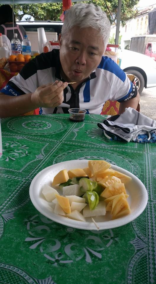
Tucking in to our refreshments eagerly
At the ice and fruit stall, just dismounted and looking rather dazed from the gravity of the earth.


This shot was taken before the fruits and drinks arrived


We finished our refreshments resumed our ride at a quarter past eleven, moving onwards to our second hill-climb of the morning.


1114hr Chenderiang hill and beyond, here we come

After having climbed this small hill for about half a dozen times, I didn't expect it to be difficult. I underestimated my level of fitness this time, for I soon became somewhat fatigued and had to take a break under a bridge, with the North-South Highway and its roaring vehicles above me.

It was just about five km from the Lata Kinjang waterfalls junction, and a couple of km more to the peak. We had covered 51.47km so far.


1154hr Rest stop under the NS Highway, 51.47km


1237hr The climb continues
At about one o'clock, we reached Sahom village at the foothills. It was 61.90 km of our ride.

1256hr At Sahom. Taking a break under the shade of some trees.

A momento from our stop at Sahom
We carried on our ride towards Kuala Dipang, with its junction leading to the main trunk road. It was very hot and I was getting both thirsty and tired.

1314hr Approaching the Kuala Dipang junction with the trunk road from Kampar

"Getting very hot now, tired?" my wife asked in a message on my phone.

It was 1327hr and I had almost made up my mind to return to Kampar instead of carrying on the journey with the rest to Gopeng and beyond.

"Yea hot", I replied from the road side, "Reached K. Dipang junction. Coming back on my own by main road to Bandar Baru. Not joining them to Gopeng and beyond."

That was at the 67.87km point. I broke away from Ganesan, Adrian and Thanes to head southwards back to Kampar town while they continued north to meet up with Fabian and Lee Lean Wylie in Gopeng in their quest to complete their 100 km target.


It was 75km, taking into account my 4 km unrecorded ride to Ganesan's house.

Arriving home at about 2.40 pm, it was a 75km ride for this final day of January 2018. My legs were quite well tanned and I nicknamed today's ride, "The Sun Tan Ride".


Wednesday, 4 October 2017

A morning ride to Taman Alam Kinta

Of late it has been our habit to take short - medium distance rides to some places nearby on Wednesday mornings. This morning our group of five comprising Ganesan (event host), Eugene Lim, Adrian Wong, Leroy Tan went on a 44 km ride to Taman Alam Kinta via Kota Bahru, returning by the Kinta River banks, before making our usual refreshment stop at Kenneth Sai's coffee shop, Yen Lee Thong, in Malim Nawar.

0842 hr 7.73km After the Malim Nawar intersection, waiting for Adrian.
Adrian Wong was delayed at home after fetching his children to school. He told us to set off on our journey ahead of him and he'll catch up with us soon. Three of us left Westlake Villas at the foot of the bridge over the railway tracks at about 0815hr. Not long after, Leroy caught up with us and we rode westwards along the new road that connects to Kota Bahru town. Soon after crossing the traffic lights intersection near Malim Nawar, we stopped by the road side under the cool morning sun for a few minutes to allow Adrian to catch up with us


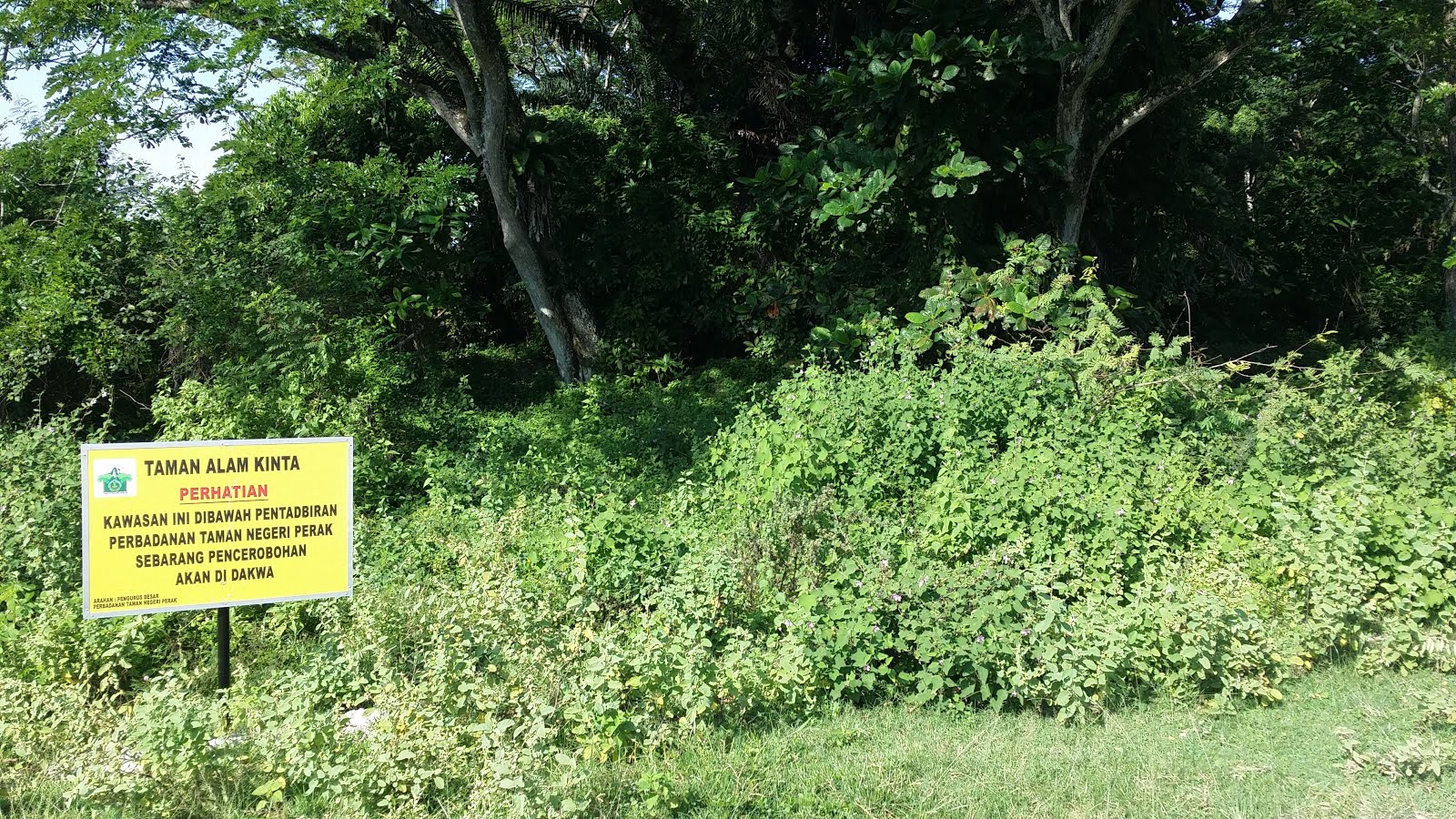
About an hour later, we passed Kota Bahru station, and were on the off road tracks approaching Taman Alam Kinta (the Kinta Nature Park), on the east side of the Kinta River.

0940hr 19.37km Approaching Taman Alam Kinta


0944hr 19.88km At the park entrance
We reached Taman Alam Kinta at about a quarter to ten in the morning and spent about half an hour there. It was a cool, shade place facing a quiet serene lake (a disused mining pool) with birds flying about while the park workers were cleaning up some dried leaves.

Location: 4° 25' 21.036" N, 101° 3' 39.4164" E
Google map link: http://bit.ly/2ynZbdQ


Some photos from the park:

With Adrian to my right. We're not twins. We're bTwins.


The still, quiet lake in the background.

 The section of the park we were in faces a large still lake surrounded by shade from many trees. It reminds me of MacRitchie Reservoir in Singapore which my wife and I visited recently for a morning hike, though not as large and well equipped.

A five-storey observation tower


There was a lonely looking observation tower about a hundred yards from the lake side. Eugene Lim decided to climb all the way to the top deck without telling us. Eventually we all followed suit and soon we were taking photos and enjoying the view and the cool fresh air from the fifth storey of the tower.

Here are a couple of photos taken from the top of the observation tower.

View from the fifth storey of the observation tower

Another tower view looking across the lake.

We left Taman Alam Kinta shortly after ten and cycled eastwards in the direction of the Kinta River, reaching the eastern river bank by about 10:15 am. I could hardly see the river because both sides of the river banks are overgrown with weeds and other undergrowth.

The Kinta River is all but hidden from view by lush undergrowth


1037hr 25.22km Taking a break by the bridge at Kota Bahru
Then we took a loop southwards and eastwards all the way back to Kota Bahru station from where we started our offroad trek earlier. We took a short break while waiting for Ganesan and Eugene to buy some food from the only coffee-shop in the vicinity.


1104hr 31.26km Taking a break under some shade at Kg Tg Bunga.
After that, we resumed cycling the final ten kilometres to the Malim Nawar junction. Our final destination was our usual coffee break at Kenneth Sai's shop in Malim Nawar. Leroy, a fast rider, went ahead of us, while Eugene Lim and me rode slower and got left behind him. Meanwhile Adrian and Ganesan, who were some distance behind us, took a short cut and reached Sai's Shop ahead of us.
We decided to stop for a break under some shade at Kg Tg Bunga, about 4 km from Sai's Shop. 

When we arrived at Sai Shop at shortly after eleven, Leroy, Ganesan and Adrian were already having their coffee and breakfast.

1119hr 35.39km At Yen Lee Thong coffee shop, Malim Nawar

After a little chit-chat, we left Malim Nawar for Kampar at about 10.40 am. I reached home about half an hour later, covering a total distance of 44.14km with 2 hr 51 min of total cycling time.

A brief description of Taman Alam Kinta is available from the Batu Gajah District Council page.

Sunday, 17 September 2017

A reach too far

Today's ride is a dry-run of next Sunday's 85km event to enter the Malaysia Book of Records as "the first and largest group tandem ride for visually impaired people", named Tour de VIP, organised by the Blind Empowerment Society of Selangor (BESS).

Taking part in this trial run are Ganesan, Sean working with St Nicholas' Home Penang, Naveen the marketing and communications manager of Grand Kampar Hotel and me.

We assembled at the Lobby of Grand Kampar Hotel and set off shortly before 0800hr


By 0802hr we have covered 7.08km as we crossed the bridge approaching the Malim Nawar - Tanjung Tualang intersection.


It took us another 17 minutes to arrive at the bridge over the Kinta River before Tanjung Tualang, at the 11.31km mark of our journey. At 0819hr, we crossed the bridge.


Sean and I were ahead of Ganesan and Naveen. We reached Chenderong at 0854hr. Sean, a friendly Irishman from Belfast, waited with me for the other two at the roadside opposite the entrance to Chenderong Village. The sun was shining in our faces.

When Ganesan and Naveen arrived, we decided to stop for breakfast at one of the coffee shops, although Sean was somewhat concerned that it's getting late and we're not covering enough ground.

This was the 21.32km point in our ride.


We tried not to take too long to finish our breakfast and, pushing on with our pedalling, we reached Batu Gajah at 0955hr, covering 28.21km of our ride.

Turning right at the traffic intersection, we crossed the tall bridge over the railway tracks below and rode on until we arrived opposite Kellie's Castle.


After passing Kellie's Castle (34.31km) at 1035hr, we reached the Shell service station on the approach to Gopeng town (42.13km) at 1110hr.

There was a Chinese confectionery shop adjacent to the service station. Sean bought us bottles of cold refreshing water from the shop. We met a convoy of superbikers who stopped by to take a break too.


Pressing on through Gopeng town, we entered the Kopisan - Lawan Kuda junction, 46.94km, at 1156hr.

Despite the hot sun overhead, we went on to cover another 14 km, reaching Kota Bahru station (60.42km) at 1310hr. The heat was enervating and I was really "feeling the heat", literally.


Eventually we reached Malim Nawar 70.22km at 1420hr after a slow laboured ride. I was suffering from the oppressive afternoon sun with sparse cloud cover. My water supply was running low.

In the end, I had to abandon the ride after getting some cold drinks at Kenneth Sai and Chooi Yin Chong ''s coffee shop. My wife drove over to fetch me home, leaving the other riders to proceed with the last 15 km to Grand Kampar Hotel.

It was a reach too far for me today.

Wednesday, 21 June 2017

New loop: Kampar - Tualang - Palm Oil Mill - Sg Durian - Tualang - Kampar

After almost a year of absence, I joined Kampar Cycling Community on a group ride to Sungei Durian via a new loop, the existence of which I was unaware for the last three and a half years of group rides with KCC.

Waiting for the other rides at Westlake Villas, a stone's throw from the bridge


The imposing Westlake Villas towers over the neighbourhood

Beautiful trees and shrubs line the pedestrian crossing in front of the Villas

Our small group of four riders, Ganesan, Theevagaraju, Adrian and me, set off from the Westlake Villas bridgehead, rode the 11km to Tg Tualang town, went on towards the direction of Kg Timah and taking a right turn into an oil palm estate road just before reaching the Kg Timah entrance. From there, we rode past the Tanjung Tualang Palm Oil (1997) Mill, took another right turn to ride through a couple of km of oil palm estate. A cobra crossed our path along the way, before we arrived at the back part of Sg Durian town.

Reached the breakfast stop at Sg Durian just before 10 o'clock, about one and a half hours after setting off from Kampar town

With Adrian Wong at breakfast table

After a brief stop for breakfast at a "house" stall, we proceeded to climb to the upper reaches of Sg Durian town before descending a few km to Tg Tualang town again. From there, we rode back the 14 km to Bandar Baru Kampar.

A brief road side stop just our of Tg Tualang heading towards Kampar town

I was the rear guard here, haha


At last reached home at about 11:45, just before noon, about three and a half hours after start time

Wednesday, 11 January 2017

PCN Central Urban Loop Singapore

Started from AMK Ave 1 Blk331 through Bishan-AMK Park, I covered the following park connectors on this 28 km ride:

Central Urban Loop
(1) Kallang Park Connector (South)
(2) Pelton Park Connector (North-east)
(3) Balam Park Connector (North, then North-east)
(4) Hougang Avenue 3 Park Connector (North-west, then North)

North-east Riverine Loop
(5) Serangoon Park Connector (North, then West)
(6) Buangkok Park Connector (South-west, West)

Central Urban Loop again
(7) Ang Mo Kio Avenue 5 Park Connector (West)

Final leg: Non PCN
(8) Ang Mo Kio Avenue 8 to Ang Mo Kio Avenue 1 (End)

(1) Kallang Park Connector (Central Urban Loop)

A section of the park connector is closed for repairs to the Kallang River bank, had to detour to Bishan Street 13 and Street 11 Temporary PCN. Then turned left on Bradell Road, crossed foot-bridge 01.

Continued southwards along the Kallang River bank, went under very low head clearance under five lanes of the CTE!

Continued south until St Andrew's School across the river on the left and St Andrew's Junior College on the right before turning left (south-east) into Toa Payoh Road.
Crossed a long foot-bridge 02 spanning another five lanes of the PIE.

Journey time: 30 minutes

Then turned right (south) into Moonstone Lane. Crossed to the right side of the road upon reaching Opal Crescent on the left, entering a PCN path heading south-west.
Took a bridge across the Kallang River and continued a short distance south-east.

At Serangoon Road I looked for a pedestrian crossing or underpass but couldn't find any. (Next time, I may need to cross back to the eastern bank of the Kallang River to my left to find it), so I had to carry my folding bike across foot-bridge 03 over Serangoon Road.

Contined a short distance along the eastern bank of the Kallang River, then crossed foot-bridge 04 over Bendemeer Road into Geylang Bahru where I continued on the eastern bank of the Kallang River until Block 65 Geylang Bahru.

Then, I crossed Kallang Bahru Road and continued south until I arrived at the Pelton Canal in front of me. Crossed the bridge over Pelton Canal to continue my journey on Pelton Park Connector.

Journey time: 1 hr 12 min

(2) Pelton Park Connector

Headed north-east on the southern bank of Pelton Canal.
Crossed under Geylang Bahru Bridge of Upper Boon Keng Road.

Just before the Kallang Bahru flyover of PIE / Sims Way, I crossed the bridge over to the northern bank of Pelton Canal.
Then I went up on a long foot-bridge 05 across the PIE to the north, facing JTC Corporation Blocks 155 - 161.

Then turned right to continue on the Southern Bank of Pelton Canal again.
After that, I headed east, crossed Aljunied Road, to a bend northwards until the T-junction of Circuit Road, then crossed the traffic-lights to continue my journey on the Balam Park Connector.

(3) Balam Park Connector

The journey continued by heading north, north-east then east until I arrived at Paya Lebar Road where I turned left (north) and crossed over to the northern bank of Pelton Canal.

There, I crossed the traffic-lights to the north across Airport Road at the intersection of Paya Lebar - Macpherson - Airport Road into the Hougang Ave 3 Park Connector

I missed the short stretch of Paya Lebar Park Connector northward ahead of me on the east side of Paya Lebar Road at the CC11 Tai Seng MRT station.

Journey time: 1 hr 42 min

(4) Hougang Ave 3 Park Connector

This leg of the journey started in front of BreadTalk THQ, continuing easwards, crossing the traffic-lights junction at Tai Seng Ave, followed by a short distance of riding north-east before turning left (north-west) into Hougang Ave 3.

I continued to head north-west, crossed another traffic-lights under the Bartley Viaduct, then at the junction of Lorong Ah Soo, I crossed the road to the east side of Hougang Ave 3.

After going over a small bridge, I continued northwards on the west bank of the Serangoon River tributary, crossed Defu Lane 10 and headed north, and north-east
Then I crossed over to the north side of Tampines Road at a traffic intersection into Hougang Ave 7.

This brought me into the Serangoon Park Connector, which began my journey on the North-East Riverine Loop.

Journey time: 2 hr 43 min

(5) Serangoon Park Connector (North-East Riverine Loop)

Went along the western bank of the Serangoon River, heading north-east until I arrived at the confluence of Sungei Pinang and Sungei Serangoon.

Turned left at Block 477 to ride along the southern bank of Sungei Pinang, heading west. Due to some roadworks, I had to detour into Punggol Park and exit at Hougang Ave 10.

Crossed Hougang Ave 10, westwards into Buangkok Drive, and continued riding west along the southern bank of Sungei Pinang, passing by the Sengkang Fire Station.
Crossed the intersection at Hougang Ave 6 / Sengkang Central, followed by the intersection with Buangkok Green where I crossed over to the north side of Buangkok Green.

The Serangoon Park Connector ended there.

Journey time: 3 hr. Distance covered: 21 km

(6) Buangkok Park Connector

Went south-west along Buangkok Green, crossed the intersection at Hougang Ave 4 / Buangkok View, then westwards until Buangkok Lane / Hougang Street 93 intersection.

After crossing the intersection, I passed Block 980B all the way to Block 987C before crossing Yio Chu Kang Road to begin the next leg of the journey on the AMK Ave 5 Park Connector, which forms the northern arc of the Central Urban Loop.

(7) Ang Mo Kio Avenue 5 Park Connector (Central Urban Loop again)

Rode westwards along AMK Ave 5, crossed traffic lights under the AMK North Flyover of the Central Expressway. Then passed by ITE College Central followed by Nanyang Polytechnic.

At the intersection with AMK Ave 8, I left the Park Connector Network by crossing the intersection, turning into Ave 8 on my left.


(8) Ang Mo Kio Avenue 8 (non PCN)

After leaving the Park Connector Network, I headed south towards the Ang Mo Kio NS16 MRT Station, passing by Blocks 501 to 512 of Cheng San Crest neighbourhood along AMK Ave 8.

CAUTION:  Cycle cautiously on the road. Do not use the narrow pedestrian path.

At AMK NS16 MRT station, I dismounted and pushed my bike into a corridor leading to a bicycle park area.


Journey time : 3 hr 48 min.

After leaving the MRT station, I cross the traffic light intersection with AMK Ave 3, then took the new bicycle lane under the MRT tracks all the way home to Block 331 AMK Ave 1.


Total journey time : 4 hr
Total distance covered : 28.15 km


--- End of Central Urban Loop Ride ---

Saturday, 10 December 2016

Singapore PCN Solo Ride AMK to Punggol Waterway Point


Went out on a short ride to Punggol Waterway Point. Distance: 12km Cycling time 54 minutes via AMK Ave 1 - Ave 6 - Ave 5 - Punggol Park Connector along the southern bank of the Sungei Punggol, passing through Sengkang Riverside Park.


Bicycle stairway leading down from Yio Chu Kang Rd to the banks of the Punggol River, start of Punggol Park Connector

The scenic Waterway at Punggol Waterway Point

The huge Waterway Point Shopping Complex

Walking the C2C Trail: from CP6 to CP7

Our second leg of walking the Coast-to-Coast Trail, from CP6 to CP7, took place on Sun 2019.09.22, a day after we completed our first l...